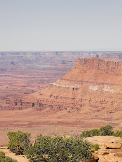
Wednesday, September 30, 2009

Mesa Verde


Spruce Tree House

“Mesa Verde National Park is also an International Heritage site which includes over 4,500 archeological sites; only 600 are cliff dwellings.” Only 600—only 600!

Where do you begin?

Before we left home I downloaded the park brochure and other information. We looked at it prior to our visit. Two of the largest and most famous cliff dwellings—Cliff Palace and Balcony House could only be toured with a ranger and we determined that it would be too strenuous to visit those due to the many steps and ladders.

We spoke to the ranger at the Visitor Center. The Visitor Center is the only place you can get tickets for the ranger-guided tours and they help you decide what to do. The ranger confirmed what we thought and suggested visiting Spruce Tree House and the Mesa top sites and overlooks as well as the Chapin Mesa Museum. That is what we did.

After visiting the Chapin Mesa Museum where the artifacts ranged from pottery to textiles, we took the path to Spruce Tree House that begins just outside the museum. The asphalt path zigzagged down to the level of Spruce Tree House.

Tom overlooking Spruce Tree House

Tom at Spruce Tree House

Spruce Tree House, the best preserved cliff dwelling, is a self-guided tour. Rangers are posted at the site to answer questions and to keep people from climbing on the walls. Spruce Tree House is 89 ft. deep and 216 ft. across. It contains 114 rooms and is the third largest cliff dwelling in the park. It is believed that 100 people lived in Spruce Tree House. We purchased a booklet describing the features of the structure. I was able to climb down into a kiva, a religious structure. Ceremonies to ensure successful hunts, crops and good weather took place in kivas such as this one.

We then visited several of the mesa top sites and viewed many of smaller cliff dwellings from the overlooks. A highlight was the view of Cliff Palace. This is the cliff dwelling that is most associated with Mesa Verde.

Cliff Palace

Wildlife Detection Area

There were electronic signs on one section of US Hwy. 160 that were triggered by wildlife activity in the area of the sign. There must have been a motion sensor of some kind.

We passed several of these signs and then the last one said, “end wildlife detection area”.. About ½ mile after the final electronic sign two deer decided to cross the road. The first one crossed while we were still pretty far away but the second hesitated and finally crossed about 20 ft. in front of us. I guess those two weren’t told of the animal detection area.

http://www.dot.state.co.us/communications/insider/PDFs/160wild.pdf


Overcoming Fear, Well Not Quite

I wrote about Arches’ dramatic entry road. Arches can’t hold a candle to Mesa Verde.

In 2003, we went to Mesa Verde. Well shall I say we got to the Visitor Center 15 miles into the park. I was in hysterics—shaking and sobbing. Why? They are what I call vertical miles. The ascent from the park entrance was 1040 ft. to the Visitor Center. We drove up in our old motorhome, the squirrelliest thing on 4 wheels. All I could see out my window was sheer drop-offs. Tom did an excellent job driving that was not the issue. It was the way the motorhome handled and the road.

I was determined this time to tour Mesa Verde. We took the car and I drove up, and down, as well as the tour of the mesa. I had to drive to help me overcome my fear. Again this had nothing to do with Tom’s driving, just my extreme fear that has been built up in my mind since 2003.

Tuesday morning we began the long haul home. This leg was 257 miles. That took us over two mountain passes on US Hwy 160, which for the most part is a two-lane road. They do have passing lanes when there is a grade for slower moving vehicles. Wolf Creek pass was the first and by far the worse one at 10,850 ft. The climb was very slow. First we shut the overdrive off, then down to second and finally first gear straining up at 15 mph. If that wasn’t enough there was road construction near the summit.

Of course what goes up must go down. The descent is mostly 6%, which is a relatively easy grade but there was 12 miles of it. Many of the curves were posted as 25 or 30 mph. I think to go at those speeds would have taken nerves of steel. One of the 30 mph curves was through one of the two tunnels.

The next was La Veta pass at 9413 ft. This would have not been bad either way had it not been for one section without a shoulder or guardrail and the wind. Fortunately the time the wind really caught us, there was a shoulder. The speed limit was generally set at 65 mph with some curves down to 50 mph. We went considerably slower.

Open Range


Cattle on the road.

If you see an open range sign expect to see cattle near or on the road. Most often you will see an open range sign and no cattle at all. Or on your way somewhere there will be no cattle as far as the eye can see and when you return, cattle near the road. Cattle are not road savvy. If they are near the road as you are approaching, just assume they will be in the road by the time you get there.

Cowboys are not a thing of the past. The summer ranges are scattered over miles of open range and cowboys gather the herds together to go to market or winter pasture. We did see a cowboy and his two cattle dogs in action near Flaming Gorge, herding the cattle toward some pens that were setup to hold them until they could be loaded into a cattle truck. There are pens of this type all over.

Round 'em up.

There are fences but they seem to divide ranges and do not keep the cattle out of the road like they do back home. When there is a road there is a cattle guard (a metal rumble strip that the cattle cannot cross) that keeps the cattle in their own range. The ranges are so vast out west because the food the cattle graze is sparse. At home you may need an acre to support one head of cattle, out west you may need 25, 50 or 100. Of course water is an issue. No matter how many acres of land you have to graze, the cattle must have a source of water. I read the figures somewhere and will need to look them up, but I thought it said the cattle had to have a water source within two miles.


Who presses the button?

Wildlife

Snake at Escalante

Lizard at Mesa Verde

Buffalo (probably belonged to someone)

Pronghorn

Mule Deer

Black-Billed Magpie

Stellar’s Jay

Mountain Bluebird

Lesser Goldfinch

Bald Eagle

Golden Eagle

Lewis Woodpecker

Coyote

Black-tailed Jackrabbit

Kangaroo Rat

White-tailed Antelope Ground Squirrel

Snake of undetermined species

Eastern Fence Lizard

Western Pipistrelle Bat

Jay, Pinyon or Western Scrub

Falcon, Prairie or Peregrine

Western Meadowlark

Western Bluebird

Cliff Swallow

Osprey

Northern Harrier

Cooper’s Hawk

Tarantula

Nighthawk

Armadillo (dead)

Sunday, September 27, 2009

Moab Part 3-Canyonlands Needles District


Newspaper Rock

We traveled 200 miles by car to Canyonlands Needles District. It was a long way to go for what we were able to see. There were no grand vistas from the various overlooks. The high point was Newspaper Rock on Utah Hwy 211. The rock is jam-packed with petroglyphs, hundreds of petroglyphs. Some of the images on rock were deer, birds, people, footprints and squiggly lines.


On a hike.


View from the Needles Overlook.

On the way back we stopped at the Needles Overlook, which was located at the end of a 22-mile road off Hwy 191. The Overlook allowed us to safely look down into the canyon. There were very securely attached railings with chain-link fencing. I even felt secure leaning over for a look (after first testing to see if it wiggled).

It was a six-hour day and the temp was 99. By the time we got back we were both frazzled. We left the boys in the motorhome with the AC on and they were good while we were gone. We had a chance to rest a little then change for dinner show at the Bar M Chuckwagon.

All the dinner guests gathered outside for the shootout. There were two tour groups from France and one from Japan. I thought the dinner was delicious. Sliced roast beef, baked beans, baked potato, applesauce and spice cake. The show was good. The folks in the show did everything from selling tickets, to the gunfight, to serving food and drinks.

Some of the guests were asked to go on stage for one song and twirl little lariats. It was pretty funny. An older Japanese lady was one of the people called on stage. They said that she had hiked 3-miles to Delicate Arch that day. She was just a little thing. What spunk.

Friday, September 25, 2009

Moab Part 2--Arches


Went to Arches National Park today. Entering the park is dramatic to say the least. The road makes a series of switchbacks as it climbs up the face of the cliff. From the bottom the cars, motorhomes and tour buses look like ants as they make their way to the top.


If you enlarge this photo you will see a white speck. That is a motorhome going up the entrance road to Arches. We are at ground level.

Almost immediately after the road levels out, you see the impressive formations called Park Avenue. Followed shortly by The Organ, Courthouse Towers, Three Gossips and Sheep Rock. There are many more unnamed pinnacles, spires, sandstone fins and eroded monoliths.


Park Avenue

Most of the Arches are only accessible on foot. There are several that you can see from the road or overlooks but the famous Delicate Arch and Landscape Arch require hiking.


It took about four hours to drive the whole park. Parking spaces are at a premium. Cars park in RV/Bus spaces so RVs end up parking in car spaces and buses where ever they can. Again I don’t remember it being so busy five years ago.


Congestion


Musical RVs

When we made reservations at this campground we were told that we could have two nights in one space and two nights in another. We were willing to move as we did call at the last minute.

Apparently the move was bigger that just us. The big move involved four rigs who moved to different spaces and two who departed. No one could move until those two departed. I must say this left us all scratching our heads. We discovered that four rigs pulled in together and took the four spaces that were freed up. They were traveling together.


Moab, UT Part 1

Tom at one of the overlooks.

From another overlook.

The focus of our visit here is Canyonlands National Park. Last time we were here we visited Arches National Park and our schedule didn’t allow us to see Canyonlands.

After setting up at the campground at about 1:30, we headed toward the park. We chose the nearest road, as we didn’t want to be gone too long.

This road followed the Colorado River as it meandered its way into the park. The paved portion of the road is only about 20 miles then it turns to a 4x4 road. We didn’t take the 4x4 road. It was a nice ride.

It’s not till you get on the rim that you appreciate how Canyonlands got its name. The Green and Colorado Rivers merge within the park and these are the forces that etched this huge canyon into the earth. The park covers 527 square miles and in places the canyon is nearly a ½ mile deep. The vista stretches to the horizon 100 miles. The color of the sandstone is in varying layers of brown mostly, almost a chocolate brown—A much different color compared to the other areas we have seen. At mid-day, when we were there, the canyons had a very dark appearance. Brochure pictures show flaming red to golden colors on the rock at sunset.

Green River Overlook

We took the park roads to all the overlooks in the Island in the Sky region, which is the easiest way to see the park. The more adventurous visitor can get down into the canyons. From the rim you can see 4x4 roads where you can either take your own vehicle, rent one or be guided. Some trips into the canyons can take days and permits are required for certain activities. I don’t know if they charge for the permits or just want to know your plans. It can be a dangerous place. The canyons are quite warm, 1/4 in of rain can cause some washes to flood and dehydration is a concern.

The plan is to go to the Needles region on Friday or Saturday.

The La Sal Mountains to the east. The highest peak is Mt. Peale at 12,721 feet.

Shafer Trail (4x4) approaching the visitor center.

Grandview Point Overlook. Wind noise is loud so turn your sound down.

Thursday, September 24, 2009

My New Favorite Place Is Capitol Reef
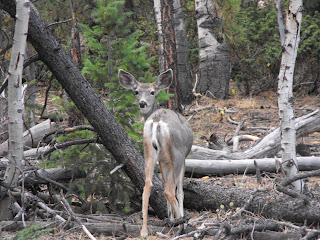

A 100 mile long "Waterpocket Fold" in the earth defines Capitol Reef. Much of the park is accessible only by backpacking. The historic Fruita area and a 10 mile paved park road are easy to visit.

Fruita was a small community settled in the 1880s by Mormon settlers. The Fremont River allowed settlers to farm, creating the many orchards that exist today. At most, only ten families lived in this valley, which was somewhat isolated due its remote location.

Franklin Roosevelt designated Capitol Reef a National Monument, then in the 1960s Capitol Reef was established as a National Park. Utah Hwy 24 was paved around that time and access to the area became easier. Today the park’s facilities—visitor center, historic buildings, orchards park road and campgrounds can be found just off Hwy 24.

Our campsite at sunset.

We really enjoyed the campground that is adjacent to one of the orchards. The fruit is Pick Your Own for $1.00 per pound, with bags and scales available. Several herds of mule deer browse the orchards with the human visitors. There are shower/restrooms available. The camping is dry as there are no hookups at the sites. There are no reservations and we were lucky to get there early enough to get a spot. The campground filled shortly after we arrived. Although the campgrounds were full, there weren’t the crowds as in other parks we visited.

These mule deer are local park residents. You can see they aren't bothered as this man approaches.

We took the park road; the first 10 miles are paved. At the end of the pavement you can take the South Draw road/ trail which connects with Hwy 12 to the west but is designated for high clearance 4x4 vehicles or the mile long Capitol Gorge road, which is a must see. We drove along a wash and at the end is a hiking trail that leads to petroglyphs, pioneer writing and the tanks, rock pockets where rainwater collects. We walked a short way together and Tom turned back. I continued on alone for a while and would have kept on going if someone else were in sight. But being the chicken that I am turned around and came back.

Tom on the Capitol Gorge trail.

We came back and drove the park road and Grand Wash after supper. I wanted to get some pictures with the setting sun hitting the rocks. The setting sun seemed to make the cliffs glow. It was quite beautiful.

Sunset at Capitol Reef

We went to the ranger program that evening but it got so cool that we didn’t stay for the whole thing. We didn’t dress properly. When you stay at a state or Federal campground you can easily take advantage of the ranger programs and activities.

Sue in Capitol Gorge

Tuesday, September 22, 2009

It's Cold in Them Thar Hills


Summit Scenic Byway 12

The past couple of days have been quite windy. At our campsite in Escalante the wind blew so hard you could feel the sand hitting your legs as you walked and it smarted. Yesterday morning it was the same as we prepared to head over the mountains from Escalante to Torrey. I was somewhat concerened about the wind and the high mountain roads. As it turned out that was not a problem. in the video you can hear just how windy it was.

When we were driving up on the mountain on the Fish Lake Loop it was COLD. The wind was blowing really hard and the aspen leaves were glistening in the sun as the wind caught them and Fish Lake had white caps.
Fish Lake Loop

Aspens on Fish Lake Loop

Monday, September 21, 2009

More on Mountain Driving

I know I have mentioned mountain driving in at least one past blog entry, but it deserves a little more attention.

Today we took the much-dreaded Scenic Byway 12 from Escalante to Torrey, UT. We inquired at the Interagency Visitor’s Center after reading that the road’s summit was 9800 feet above sea level. We were told that the road did have a 9800 ft. summit and that there are many steep grades and switchbacks.

Yesterday we had decided to head to Boulder, UT in the car to see the Anasazi State Park Museum in a valley over the first set of mountains. I drove. The road is just as advertised—scenic, but who had the time or nerve to sightsee. There were turnouts and scenic overlooks, which we took advantage of. The views, when stopped, were fantastic. There were two sections that had 14% grades and many more 8%. One section of road went across a spine between two mountains and it was difficult not to see the sheer drop-off on each side of the road. This road is not for the feint of heart. Tom took photos and video both when we were stopped and moving.

We made it there and back fine but we knew we would be heading back with the motorhome the next day. We decided to drive separately. Why pull an extra nearly 4, 000 lbs. up these winding roads and then try to slow both vehicles on the way down.

This morning took the Scenic Byway 12 drive. Tom was at the wheel of the motorhome and I was driving the Suzuki. The 70 miles took us 2.5 hours. By far the worse portion was the first section, the one we took yesterday.

If that was not enough after we got settled at our campsite, we took off again. We buckled the boys into their car seats and drove the mountainous Fish Lake Loop. The sagebrush and cedar trees disappeared and it was like being in another world--blue mountain lakes, streams and groves of quaking aspen that were brilliant yellow to orange.

We came home and took a nap.

People

Met some very nice people on this trip. At Flaming Gorge, we were parked next to a nice couple, who always took time to say hi or chat. As they were getting ready to leave the man came over to say goodbye. That was really nice. At Bryce Pines the folks next to us and behind us were very friendly and of course the couple from Wisconsin. At Escalante we have met some very nice folks and their big boy Chihuahua, Chico. Who were completing an unfinished trip they started last year when they were called home to assess damage when hurricane Ike struck near their home in Texas.

Not too many years ago you would take a campground walk and visit with those you would encounter. Now many don’t want to talk. They are not rude they just keep to themselves. I’ve been trying to think of some possible reasons. I can come up with a few. Full-timers—this is not a vacation for them it is their lifestyle, an everyday occurrence. Satellite television—years ago you sat outside and were available to visit. Now folks are tied to their televisions and are not outside. Younger people—they don’t have anything in common with the older generation. They are out doing it all. Biking and hiking are the most popular activities it seems. Traveling in groups—they have no reason to go outside their circle of friends. For instance, at the Pines there were members from a bicycling club from California camped near each other and they pretty much stayed to themselves.

So the friendly people are like gems. They are harder to find, but well worth it when you do.

Grand Staircase-Escalante National Monument


Our campsite at Escalante Petrified Forest State Park

Our base for three nights is Escalante Petrified Forest State Park. We arrived early, as we were only 50 miles away. It did take us two hours to drive it though. It was up and down and around. At one point the motorhome was down in first gear. Fortunately it was a good road so I was only scared not really, really, really scared.

Of course we arrived too early to get into our spot so we parked near the office, left the boys and went to the Interagency Visitor Center as the park is managed by the Bureau of Land Management and under the umbrella of the Department of the Interior and NPS. After we finished there we came back and our space still was not vacated so we put the boys in their car seats and drove 30 miles to the turnoff to Kodachrome Basin State Park. The park entrance was an eight-mile drive from Hwy 12. This brought us to a hidden treasure with bright red rocks, hoodoos and spires. We attempted to take a dirt road to see the Grosvenor Arch but after two miles or so down the washboard road we decided to cut our losses and return.

Escalante-Day 2

Did the stargazing with the naturalist last night. It was amazing the number of stars. We even saw our nearest neighboring galaxy, Andromeda. We were told some of the stories behind the names of the constellations. There were about 30 people out to see the stars.

This morning we went with the State Park naturalist on a back country hike. It was us and one other couple. We told our guide that we would only go part way as we didn’t think we could do the climbing involved in the 5-mile hike. Are you kidding? I couldn’t tell you if either of us ever walked or hiked 5-miles even when we were young. So we parted ways when they went up and we followed a wash for about a ½ mile. As long as we stayed in the wash we couldn’t get lost. It was like walking on a sidewalk for the most part. The surface was hard and fairly even. We saw coyote and deer tracks and more nice scenery.


Tom on our back country hike.

After that we took a 17-mile gravel and dirt road to Devil’s Garden. This was a good site for us as you could walk into it without climbing. You could walk among the hoodoos and arches. Wildlife today was a snake—undetermined species. This was located in Grand Staircase-Escalante.

Devil's Garden in Escalante

On the way back we stopped for a few essentials at the grocery store in town. When we came back the campground was pretty much cleared out but this evening it was full and I saw at least three parties leave as there was no spaces remaining. They did arrive quiet late.


People Do the Strangest Things or What Are They Thinking

We nearly had an old woman fall in front of the motorhome in Zion. We were near Checkerboard Mesa and for some reason about 10-15 people had crossed the road from the scenic turnout and climbed a large (size of a house) rock. This was not a designated viewing area. Well I saw this old women coming down off the rock toward the road as we were approaching, stumble in loose sand at the bottom and almost fall into the road. We were only going 10-15 mph as it was a congested area, but I am not sure we could have stopped if she had fallen in front of us.

Then there was the young lady in the dress and flip-flops coming up the steep Navajo Trail Loop at Sunset point at Bryce. How far had she gone? I don’t believe that she hiked the whole loop as I think her feet would have been a mess.

People, in droves, walk down the middle of the road, dart into the road for a picture or stand very close to the side of the road to pose. They will go out on ledges for a better look or a photo. A woman at the Bryce Shuttle station said when she was driving home one evening, someone was laying on the double yellow lines taking a worms-eye view photo of the one of the two tunnels on Hwy 12 between Panguitch and the park.

I will add more. I’m sure there will be more.

Bryce’s Top 10 Causes of Injury (from their newspape)

#10 Unsafe Driving

#9 Climbing / Sliding Down Cliffs

#8 Feeding Animals

#7 Ignoring Extreme Weather

#6 Dehydration

#5 Leaving The Trail

#4 Over-Exertion

#3, 2, 1 Bad Choice Of Footwear

Bryce averages less than one fatality per year. Causes in order most to least:

Heart Attacks

Falling off Cliffs

Lightning

Vehicle Accidents

Bryce Canyon

Bryce Canyon was named after Ebenezer Bryce, who first settled the area. It is not actually a canyon though, but an “amphitheater” of cliffs, hoodoos and pinnacles in pink and orange. What a place. I am running out of superlatives to describe the sights we have seen.

We left the motorhome at about 9 a.m. and parked at the shuttle parking lot just outside the park. We had about a 20-minute wait for the shuttle to arrive. Met a couple from France, who Tom asked if he could take their picture for them. This set the stage for the remainder of the day. Whenever he saw a couple or family he asked if they wanted their picture taken. What a nice guy.

The shuttle is the way to go. Get on get dropped off, get on again. No muss, no fuss.

Unfortunately the shuttle does not go to the far end of the park, which is about 20 miles from the visitor center. So we did the shuttle stops in the morning and because we were so close to the campground went home for lunch and then went back and toured the remainder of the park using the car.

We did mostly the scenic overviews but we did attempt one trail. We knew we wouldn’t be able to make the entire thing and after we got on the trail and began walking down we encountered those coming up gasping for breath. Not just older people but young thin and very fit looking folks. So we decided to go down a little way and come back. The trail switch-backed, the railings disappeared and we came back shortly after that. We did see one young lady who was coming up the trail wearing a dress and flip-flops. I can’t imagine she went very far dressed like that.


Wednesday, September 16, 2009


This is the entrance to the 1+mile long tunnel in Zion.

We left Zion this morning. At the entrance gate we paid the $15 to go through the tunnel as we headed for the eastern entrance of the park. Large vehicles need to make these arrangements as the tunnel is curved at the top and large vehicles, such as our motorhome must go right down the middle of the tunnel so traffic must be stopped at the opposite end to allow us passage.


Stopped for a picture on the way out of Zion. In the background you can see the tiny little wall I mentioned.

I must tell you now about the road. It is NARROW. There is no shoulder to speak of and at least six switchbacks. Guardrails are non-existent. The feeble attempt at a barrier at the sides of some of the curves were probably made in the 1930s before anyone even dreamed of driving 14,000 lbs towing another 3800 up and down those canyon walls. Of course it's the same old story, I'm looking down, when I dared to, from my lofty perch and can't see the side of the road. What an invigorating way to start the morning. As soon as we exited the park there were real roads.

On the way today all the B & Bs, dude ranches, and cabins had no vacancy signs. I lost count of the number of tour buses heading for Zion.


On the way to the campground we came through Red Canyon.

We are staying at Bryce Pines Store and Campground just eight miles from Bryce Canyon . As Tom was registering a young man approached the motorhome to look at the boys who were on the dash. I opened the window to say hi to him. He was traveling by motorcycle and I said he was traveling light not like us. When he responded he had an accent so I asked where he was from. He haled from Korea and is on a trip around the world. Yes world.


Our campsite in the pines.

Well Bryce Pines is really nice. We are nearly 8,000 feet above sea level and the air is thin for us flatlanders. Our campsite is in a grove of Ponderosa Pines and the sky is so blue.

Well we set up camp, had lunch and headed for Cedar Breaks about sixty miles away. We took the car, yeah. Again up winding mountain roads but no switchbacks this time. It was a beautiful drive.


Cedar Breaks

Again another awesome view. We were at 10,300 feet looking down at a canyon full of spires called hoodoos. There were some arches, which the ranger lady kindly pointed out to us, as well as a several thousand-year-old bristle cone pine (they did a core sample of the tree to determine it's age). We saw a Bald Eagle sitting on a rock next to the road. It was probably about 4 years old as his head was just turning white. We saw mule deer, cattle right on the road and the fattest chipmunk we have ever seen eating flowers right at the visitor center door. Well worth the 120 mile round-trip ride.

Mule deer along the road.

The fat little chipmunk eating flower heads at the Cedar Breaks Visitors Center.

Met a couple from near Milwaukee at our campground and had a nice visit with them. Talked to a woman for California while I was doing laundry. They are returning from Idaho and will be home in two days. They are traveling with two yellow labs and have a cute Airstream trailer.